Products Description
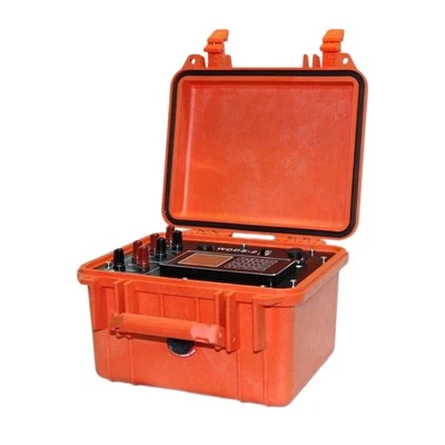
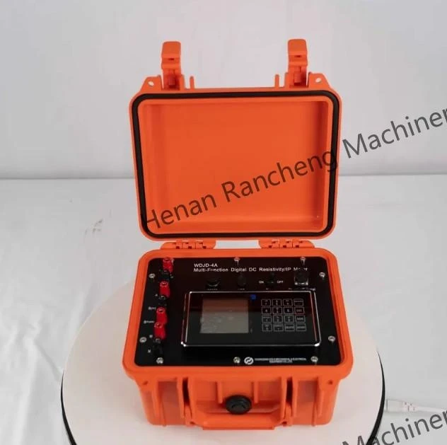
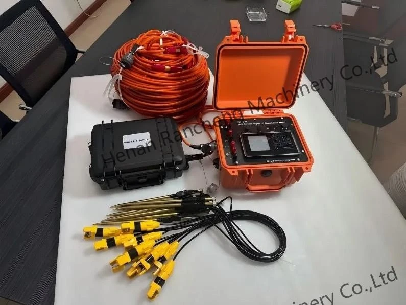
The WDJD-4A Electrical Resistivity Imaging Equipment is a high-density geophysical data acquisition system developed for subsurface electrical imaging and engineering geophysical investigation.
The instrument uses a 32-bit microcontroller and high-precision 24-bit A/D conversion technology to collect detailed electrical resistivity and induced polarization data. Rather than relying on measurements from a single point, the system uses multi-electrode arrangements to acquire a large amount of field information along a survey profile, providing the data foundation for two-dimensional and three-dimensional subsurface imaging.
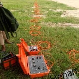
The WDJD-4A supports both centralized multi-electrode switching and distributed electrode survey configurations. More than 18 electrode array methods are available, allowing survey teams to select an appropriate configuration according to the target structure, survey-line length and site conditions.
Field operation is handled directly through the instrument's LCD interface. Measurement parameters can be configured before acquisition, while collected readings and survey records can be checked and stored during the investigation.
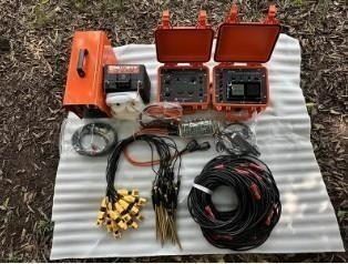
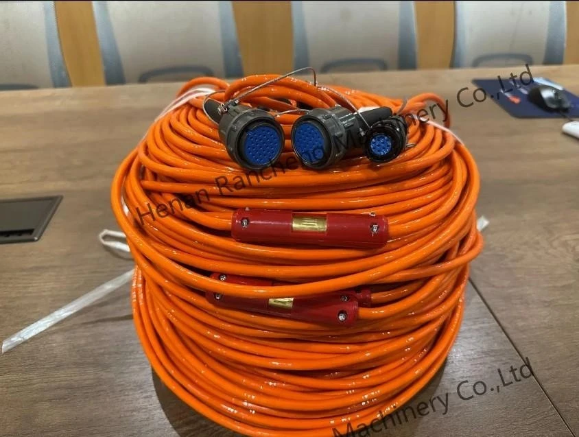
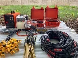
A complete system can include the main instrument, multi-core survey cables, cable reels, electrode accessories and compatible resistivity inversion software, creating a practical workflow from field acquisition to data processing and resistivity imaging.

Key Technical Specifications
1. Receiver Section
□ Voltage channel: ±50V, ±0.2% ±1 LSB, 24-bit A/D
□ Maximum voltage sampling resolution: 0.01μV
□ Input impedance: ≥100MΩ
□ Apparent polarizability measurement accuracy: ±1% ±1 LSB
□ SP compensation range: ±10V
□ Current channel: 6A, ±0.2% ±1 LSB, 24-bit A/D
□ Maximum current sampling resolution: 0.02μA
□ 50Hz power frequency interference suppression: >80dB
2. Transmitter Section
□ Maximum transmission power: 7200W
□ Maximum output voltage: ±1200V (i.e., 2400Vp-p)
□ Maximum output current: ±6A (i.e., 12Ap-p)
□ Output waveform: Pulse width 1–60 seconds, 1:1 duty cycle, bipolar
3. Others
□ Display: LCD
□ Storage capacity: ≥1GB
□ Power supply: Built-in 12V/9Ah lithium battery (or external 12V power supply); continuous operation for over 30 hours
□ Main unit interfaces: A, B, M, N; DC high voltage; external battery/charging; 2 interfaces for distributed high-density cables; RS-232 and USB, etc.
□ Dimensions: 270mm × 246mm × 175mm
□ Weight: ≤4.4kg
□ Operating temperature: -10°C to +50°C, 95% RH
□ Storage temperature: -20°C to +60°C
WDJD-4A Electrical Resistivity Imaging Equipment Features
- High-Density ERT Data Acquisition
Collects large volumes of resistivity data along a survey line for efficient subsurface imaging.
- 2D & 3D Resistivity Imaging
Works with inversion software to generate clear 2D sections and 3D models of subsurface resistivity distribution.
- 18+ Electrode Array Configurations
Supports more than 18 survey arrays for different geological and engineering investigation requirements.
- Centralized & Distributed Survey Modes
Provides two multi-electrode survey modes for flexible field layouts and different survey-line lengths.
- Fast Field Measurement
Hundreds of measurement points can be acquired in approximately 15 minutes under suitable conditions, reducing field survey time.
- 100 Preset Parameter Groups
Stores up to 100 electrode-spacing settings, allowing operators to quickly recall commonly used configurations.
- Built-In Fault Diagnosis
Helps identify connection problems and abnormal components during field measurements for faster troubleshooting.
- Multi-Level Interference Suppression
Reduces the influence of electromagnetic noise from power lines, construction sites and other electrically noisy environments.


Application
Engineering Geological Investigation
Use resistivity imaging to investigate subsurface structures before construction and identify changes in underground geological conditions that may affect engineering work.
Urban Underground Investigation
The compact field system can be used for geological mapping and underground structure investigation in urban areas, including sites affected by existing buildings, roads and utility infrastructure.
Road, Railway and Bridge Surveys
ERT profiles can help investigate bedrock depth, geological interfaces and subsurface anomalies along planned transportation infrastructure corridors.
Landslide Investigation
Electrical resistivity sections can provide supporting information for investigating geological boundaries, fractured zones and possible subsurface structures associated with unstable slopes.
Dam and Levee Inspection
Resistivity imaging can be applied to investigate abnormal subsurface zones around dam foundations, embankments and levees as part of geological and infrastructure condition assessments.
Geological and Mineral Reconnaissance
The WDJD-4A can also be used for preliminary investigation of subsurface electrical anomalies and geological structures in mineral and geological research projects.
Why Choose WDJD-4A Electrical Resistivity Imaging Equipment?
The WDJD-4A Electrical Resistivity Imaging Equipment is designed for field teams that need efficient data acquisition, flexible survey layouts and clear subsurface imaging in engineering and geological investigations.
More Data in Less Field Time
High-density multi-electrode acquisition allows hundreds of measurement points to be collected in a short time, reducing repeated manual operations and improving survey efficiency.
Clearer Subsurface Information
Resistivity data can be processed into 2D sections and 3D models, helping engineers and geologists identify geological boundaries, abnormal zones and subsurface structural changes more easily.
Flexible for Different Survey Lines
With centralized and distributed survey modes plus 18+ electrode arrays, the Electrical Resistivity Imaging Equipment can be configured for both compact investigation areas and longer survey profiles.
Better Adaptation to Complex Sites
Multi-level interference suppression helps maintain measurement stability in environments affected by power lines, urban construction and other electrical noise.
Less Repetitive Field Work
Up to 100 groups of electrode-spacing parameters can be saved and recalled directly, reducing repeated setup and manual input during multiple survey lines.
Faster On-Site Troubleshooting
The built-in diagnostic function helps operators locate connection and hardware problems without immediately stopping the entire field campaign.
Hot Tags: electrical resistivity imaging equipment, China electrical resistivity imaging equipment manufacturers, suppliers, factory, earth resistivity, earth resistivity tester, high resistance meter, instrument for measuring earth resistance, low resistance meter, resistivity meter