Seismic activity is one of the most common natural phenomena on Earth, with millions of earthquakes occurring every year. While earthquakes are often associated with natural disasters, controlled seismic waves play a completely different role in geophysics. We use artificially generated seismic waves to explore underground structures, a method known as seismic exploration, which has become one of the most effective tools for oil and gas discovery.
Over more than a century of development since the mid-19th century, seismic exploration has evolved into a core technology that allows us to "see" beneath the Earth's surface.
What is Seismic Exploration?
Seismic exploration is based on the propagation of waves through subsurface layers. When seismic waves travel through the ground, they interact with different geological formations. These interactions generate reflected and refracted signals that can be captured and analyzed.
We typically rely on two main methods:
Refraction Method
This method uses waves that bend and return to the surface when traveling through layers with increasing velocity. It is suitable for studying shallow formations or large-scale crustal structures, but its application is relatively limited.
Reflection Method
This is the most widely used approach in modern exploration. When seismic waves encounter boundaries between rock layers with different properties, part of the energy reflects back to the surface. By recording these reflections, we can reconstruct detailed images of subsurface structures.
The reflection method provides critical information such as:
- Depth and shape of geological layers
- Velocity of subsurface materials
- Changes in rock properties and impedance
How Seismograph Sensors Enable Accurate Detection
At the heart of seismic exploration lies the seismograph sensor, also known as a geophone. This device plays a crucial role in converting ground motion into electrical signals that can be processed and interpreted.
We rely on high-quality sensors to ensure that even weak seismic signals are captured with precision. In complex geological environments, signal quality directly determines the accuracy of interpretation.
The advantage of the seismograph sensor is:
- High sensitivity to detect subtle ground vibrations
- Low noise performance for clearer signal acquisition
- Stable operation in diverse and harsh field conditions
- Compatibility with multi-channel data acquisition systems

From Field Data to Subsurface Imaging
Seismic exploration is not a single-step process. It involves three major stages:
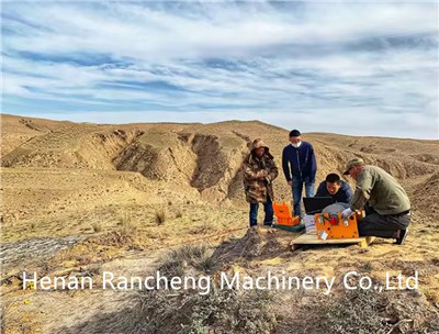
Field Data Acquisition
Artificial seismic sources-such as controlled explosions, mechanical impacts, or electrical discharge devices-generate waves that travel into the ground. Sensors distributed across the survey area record the returning signals.
Data Processing
Collected signals are often affected by noise, complex geological conditions, and environmental interference. Advanced processing techniques, including digital signal processing and algorithm optimization, are used to enhance signal quality.
Data Interpretation
Processed data is transformed into seismic profiles or 3D models. These results allow us to identify geological structures, estimate layer depths, and evaluate potential hydrocarbon reservoirs.
Improving Signal Quality with Advanced Techniques
In real-world conditions, seismic signals are rarely clean. Geological complexity, terrain variation, and environmental noise can all interfere with data quality.
To address this, we apply multi-coverage techniques in reflection surveys. By repeatedly recording signals from different source-receiver positions, we can stack and enhance useful reflections while suppressing noise. This significantly improves the signal-to-noise ratio and leads to clearer subsurface images.
2D vs 3D Seismic Exploration
Depending on survey design, seismic exploration can be divided into two main approaches:
2D Seismic Exploration
We arrange survey lines on the ground and collect reflection data along these lines. The result is a series of cross-sectional images that reveal underground structures along each line.
3D Seismic Exploration
By adding another dimension of data acquisition, we obtain a more complete and accurate representation of subsurface geology. 3D seismic surveys provide higher resolution and are widely used in modern oil and gas exploration.
Identifying Oil and Gas Reservoirs
Seismic exploration helps us determine where hydrocarbons are likely to be found. Oil and gas typically accumulate in geological formations such as structural traps or sedimentary basins.
By analyzing:
- Reflection travel times
- Amplitude variations
- Velocity models
we can predict the presence of reservoirs and guide drilling decisions with greater confidence.
The Role of Seismic Sources
Different seismic sources are used depending on the environment and exploration requirements:
Electrical spark sources generate high-frequency waves and are suitable for shallow to medium-depth exploration, especially in urban or sensitive areas.
Mechanical impact systems, such as weight drops, produce lower-frequency waves and are commonly used in land surveys.
The choice of source directly affects signal characteristics and survey depth.
Complementary Methods: Magnetic Exploration
In addition to seismic methods, magnetic field analysis can also support oil and gas exploration. Variations in the Earth's magnetic field-caused by different ground and mineral distributions-can indicate the presence of subsurface structures.
High-precision magnetometers allow us to:
- Detect magnetic anomalies
- Differentiate rock types
- Identify potential mineral or hydrocarbon zones
When combined with seismic data, magnetic exploration improves overall interpretation accuracy.
Advancements Driving the Future of Exploration
With increasing global energy demand, seismic exploration continues to evolve rapidly. Advances in computing power have enabled sophisticated techniques such as full waveform inversion and reverse time migration, which were previously limited by computational constraints.
At the same time, improvements in sensor technology are making data acquisition more accurate and efficient. Modern seismograph sensors are designed to handle complex environments while maintaining high signal fidelity.
Conclusion
Seismic exploration remains one of the most powerful tools for understanding the underground world. By combining advanced methods with reliable equipment such as high-performance seismograph sensors, we are able to map subsurface structures with increasing precision.
As technology continues to progress, seismic exploration will play an even more important role in energy discovery, resource management, and geotechnical investigation-helping us uncover what lies beneath the surface with greater clarity than ever before.