Last Updated: May 7, 2026
Busy urban roads may appear stable on the surface, but underground conditions are often far more complex. Beneath highways, municipal roads and industrial zones, hidden cavities, loose soil layers and abandoned underground spaces can gradually develop over time. Once the supporting structure below the pavement weakens, sudden road collapse may occur, causing traffic disruption, infrastructure damage and serious safety risks.
In many cities, road sinkholes are closely related to underground voids formed by long-term soil erosion, leaking pipelines, underground construction activities or abandoned mining areas. Because these hazards are invisible from the surface, early investigation has become increasingly important for municipal engineering, mining projects and urban infrastructure management.
Modern geophysical equipment now plays a critical role in underground void detection, road safety inspection and subsurface structure investigation.
Why Underground Road Voids Are Dangerous
Underground cavities are usually formed slowly over months or years. Common causes include:
Underground Pipeline Leakage
Aging drainage, water supply and sewage pipelines may develop cracks or leakage points. Flowing water continuously washes away surrounding soil, gradually creating underground cavities beneath the pavement.
Underground Engineering Construction
Subway construction, tunnel excavation and underground utility corridor projects can disturb the original geological structure. Insufficient backfilling or poorly compacted soil may leave unstable underground zones.
Geological Conditions
In karst areas, mining regions or groundwater-rich formations, natural erosion and soil loss can also create hidden underground voids.
The danger of these underground hazards lies in their concealment. Roads may still appear intact while the supporting soil beneath has already become unstable. Under heavy traffic loads or intense rainfall, sudden collapse can occur without obvious warning signs.
Urban Environments Create More Challenges for Underground Detection
Underground investigation in cities is far more difficult than in open areas.
Heavy traffic, dense buildings, underground pipelines, reinforced concrete structures and strong electromagnetic interference all affect detection accuracy. Traditional investigation methods relying only on drilling or visual inspection often struggle to provide continuous underground information across large areas.
For this reason, road inspection projects increasingly rely on advanced geophysical equipment capable of fast, non-destructive and high-precision underground investigation.
Ground Penetrating Radar for Road Void Investigation
Ground Penetrating Radar is one of the most widely used types of geophysical equipment for urban road inspection.
The system transmits high-frequency electromagnetic pulses into the ground while moving continuously along the road surface. When the signals encounter cavities, loose soil, water-bearing zones or structural interfaces, reflected signals are recorded and analyzed to identify underground anomalies.
This method allows continuous underground scanning without damaging the pavement structure.

Main Features of Ground Penetrating Radar Equipment
- Continuous road scanning capability
- Fast detection speed
- Non-destructive operation
- Suitable for municipal roads and highways
- Effective identification of shallow underground cavities and pavement defects
Because of its high efficiency, Ground Penetrating Radar is commonly used in urban collapse prevention projects and municipal infrastructure inspections.
High Density Resistivity Meter for Underground Cavity Mapping
High Density Resistivity Meters are widely used for deeper underground investigations.
This geophysical equipment measures underground resistivity differences by injecting electrical current through electrode arrays. Air-filled cavities and loose formations typically produce obvious high-resistivity anomalies, helping engineers identify underground void locations and spatial distribution.
The system supports both two-dimensional and three-dimensional subsurface imaging, making it suitable for complex geological environments.
Common Applications
- Underground cavity investigation
- Mining goaf detection
- Karst exploration
- Geological hazard assessment
- Underground water investigation
- Pipeline leakage analysis
In mining regions and subsidence-prone areas, resistivity survey equipment is frequently used to investigate hidden underground risks before collapse occurs.
Node Seismograph Equipment for Deep Underground Investigation
For deeper underground structures, node seismographs and shallow seismic survey systems are widely applied.
After seismic waves are generated artificially, underground wave propagation is recorded by seismic sensors or node seismographs. Changes in wave velocity and energy attenuation help identify underground cavities, fractured zones and weak formations.
Compared with radar systems, seismic geophysical equipment offers greater penetration depth and stronger anti-interference capability in complex environments.
Features of Node Seismograph Equipment
- Deep underground detection capability
- Strong resistance to urban electromagnetic interference
- Suitable for underground space investigation
- High data reliability
- Flexible deployment in narrow urban areas
These advantages make node seismographs widely used in tunnel surveys, underground cavity detection and urban engineering projects.

Case Study: Underground Mining Goaf Detection in Urban Area
In one underground investigation project, partial road collapse had already appeared above an abandoned gypsum mining area.
The survey area included commercial buildings, residential communities, underground parking facilities and government office zones. Limited working space and complex urban conditions created significant challenges for conventional survey methods.
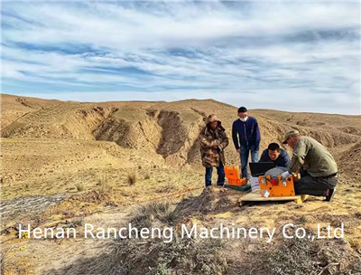
A modular node seismograph system was deployed for microtremor investigation. Compact triangular bases suitable for concrete pavement environments improved deployment flexibility without affecting signal coupling performance.
After data processing and inversion analysis, engineers obtained clear shear-wave velocity profiles showing:
- Underground cavity distribution
- Mining tunnel locations
- Ore body boundaries
- Collapse-related weak zones
The interpretation results matched actual underground conditions closely and supported emergency repair planning and risk assessment.

Case Study: Underground Air-Raid Shelter Detection
Another project involved underground air-raid shelter investigation beneath an urban area.
The underground structure extended over a long distance while the accessible investigation space remained limited. Linear arrays and circular microtremor observation systems were arranged perpendicular to the tunnel direction.
Survey results from different observation systems showed consistent low-velocity anomalies corresponding to the actual underground shelter location.
The project demonstrated the effectiveness of node seismograph geophysical equipment for underground space detection in complex urban environments.
Uneven Settlement Investigation in Industrial Areas
In another investigation project, factory roads showed surface subsidence while nearby building walls developed cracks.
The objective was to identify underground weak zones, bedrock depth and water-rich formations responsible for uneven settlement.
Using broadband three-component node seismographs arranged in linear arrays, the investigation team carried out high-precision microtremor surveys with real-time Bluetooth quality control and abnormal data screening.
Final geological interpretation successfully identified problematic underground structures and provided reliable data for engineering assessment.
Urban underground risks continue to increase alongside expanding underground infrastructure networks. Early underground investigation has become an important part of municipal safety management and engineering planning.
Ground Penetrating Radar, High Density Resistivity Meters and Node Seismographs are now widely used geophysical equipment for identifying underground cavities, weak zones and hidden geological hazards before visible surface damage appears.
Continuous underground investigation and monitoring help reduce collapse risks, improve infrastructure safety and support long-term urban development planning.